ID
 Password
|
911 West 8th Ave. Suite 100
Anchorage, AK 99501
Ph: (907)278-1023 Fax: (907)277-5718 admin@restorsci.com Mobile Contacts:
|
Projects :Water Resources
Civil/Environmental Eng Remediation/Spill Response Planning/Permitting Biological Sciences Water Resources Project/Construction Management
Matanuska River Hydrologic Reconnaissa »
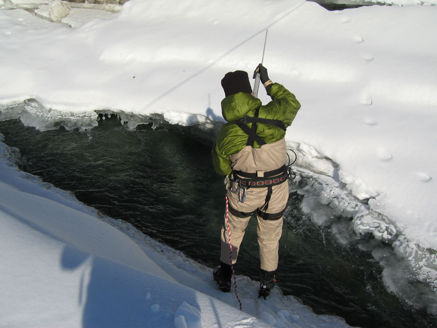
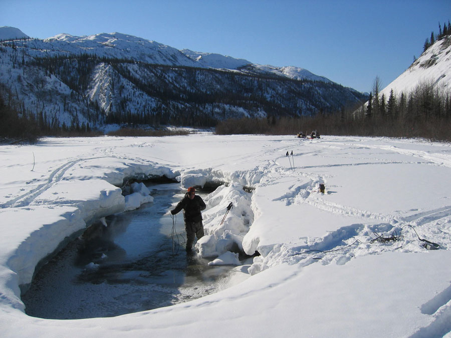
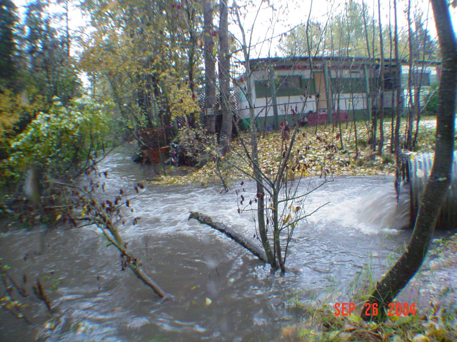
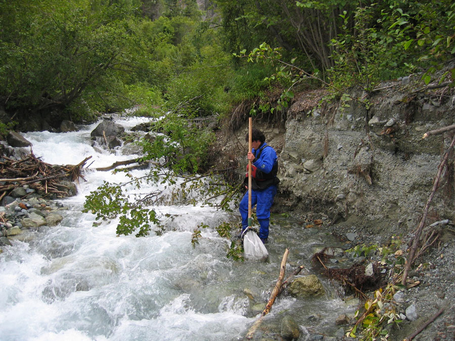 RSE conducted a baseline hydrologic reconnaissance of the Matanuska River and 19 of its tributaries. Generally, the project required both a summer (high flow) and winter (low flow) survey of the floodplain at 20 separate locations. A cross section and flow measurements were measured at each location to establish both high flow and low flow discharges. In addition to the water quantity study, RSE performed both in situ and laboratory water quality analysis, and a macro-invertebrate study on the Matanuska River and 19 of its of tributaries. RSE field hydrologists and scientist used rafts and snowmobiles to access the tributaries inaccessible by the road system. Given the remote nature of the project locations, RSE developed a comprehensive safety plan which included swift-water rescue and back country survival. The two year study resulted in a complete report submitted to the Palmer Soil & Water Conservation District for future watershed planning purposes. RSE conducted a baseline hydrologic reconnaissance of the Matanuska River and 19 of its tributaries. Generally, the project required both a summer (high flow) and winter (low flow) survey of the floodplain at 20 separate locations. A cross section and flow measurements were measured at each location to establish both high flow and low flow discharges. In addition to the water quantity study, RSE performed both in situ and laboratory water quality analysis, and a macro-invertebrate study on the Matanuska River and 19 of its of tributaries. RSE field hydrologists and scientist used rafts and snowmobiles to access the tributaries inaccessible by the road system. Given the remote nature of the project locations, RSE developed a comprehensive safety plan which included swift-water rescue and back country survival. The two year study resulted in a complete report submitted to the Palmer Soil & Water Conservation District for future watershed planning purposes. Kenai River Ground Water and Surface Water Study »
 RSE and our partners designed and installed three groundwater and surface water monitoring index stations along the Kenai River. Each station included installation of multiple thermistor strings, pressure transducers, and specific conductance probes to continuously monitor groundwater and surface water interactions along the Kenai River. RSE researched available area hydrologic studies and obtained well logs from local drillers to design the construction of these stations and multiple nested wells. Wells installed at the Pillars site illustrated the relationship between the unconfined and first confined aquifer and the influence of Cook Inlet tidal fluctuations on the local hydrologic regime. RSE correlated the groundwater fluctuations with Cook Inlet tidal data and used this data to assist development of site conceptual models. Dr. Richard Reger assisted RSE staff in logging of the wells at these sites. RSE and our partners designed and installed three groundwater and surface water monitoring index stations along the Kenai River. Each station included installation of multiple thermistor strings, pressure transducers, and specific conductance probes to continuously monitor groundwater and surface water interactions along the Kenai River. RSE researched available area hydrologic studies and obtained well logs from local drillers to design the construction of these stations and multiple nested wells. Wells installed at the Pillars site illustrated the relationship between the unconfined and first confined aquifer and the influence of Cook Inlet tidal fluctuations on the local hydrologic regime. RSE correlated the groundwater fluctuations with Cook Inlet tidal data and used this data to assist development of site conceptual models. Dr. Richard Reger assisted RSE staff in logging of the wells at these sites. Homer Soil & Water Conservation District Landscape-level Geohydrologic Cross Sections »
 RSE was retained by the Homer Soil & Water Conservation District (HSWCD) to prepare landscape-level cross section illustrations depicting groundwater flow and surface water relationships across the Western Kenai Lowlands. This EPA grant-funded project, involves coordinating with multiple organizations. The scope of work includes compiling existing data, field-truthing data, and providing a referenced report to accompany final landscape-level cross section illustrations. Information will be compiled into GIS ArcView for mapping, analysis, and presentation objectives. A conceptual model of local and regional groundwater flow is intended for application with the proposed Wetland Management Tool. RSE was retained by the Homer Soil & Water Conservation District (HSWCD) to prepare landscape-level cross section illustrations depicting groundwater flow and surface water relationships across the Western Kenai Lowlands. This EPA grant-funded project, involves coordinating with multiple organizations. The scope of work includes compiling existing data, field-truthing data, and providing a referenced report to accompany final landscape-level cross section illustrations. Information will be compiled into GIS ArcView for mapping, analysis, and presentation objectives. A conceptual model of local and regional groundwater flow is intended for application with the proposed Wetland Management Tool. ADOT/PF Anchorage International Airport Lake Hood Well Evaluation »
 RSE evaluated the effects of a multiple-screened well installed near Lake Hood at ANC, in the gradational facies of the Bootlegger Cove Formation (BCF). RSE conducted a thorough review of existing well logs, geo-environmental and geo-technical soil borings working closely with ANC GIS environmental database manager. Based upon this review, RSE developed a conceptual model of the BCF complex facies, resultant of a dynamic glacial depositional environment, with respect to the hydrologic connectivity of the unconfined and upper confined aquifers across ANC property. This evaluation included installing 2 pairs of nested monitoring wells, collecting groundwater parameters via data loggers, preparing and presenting a workplan to clients and ADEC representatives, and preparation of a final report and detailed nested well logs. RSE evaluated the effects of a multiple-screened well installed near Lake Hood at ANC, in the gradational facies of the Bootlegger Cove Formation (BCF). RSE conducted a thorough review of existing well logs, geo-environmental and geo-technical soil borings working closely with ANC GIS environmental database manager. Based upon this review, RSE developed a conceptual model of the BCF complex facies, resultant of a dynamic glacial depositional environment, with respect to the hydrologic connectivity of the unconfined and upper confined aquifers across ANC property. This evaluation included installing 2 pairs of nested monitoring wells, collecting groundwater parameters via data loggers, preparing and presenting a workplan to clients and ADEC representatives, and preparation of a final report and detailed nested well logs. Other Hydrology Projects »
       |